Overview
This is a nice circular route passing several points of interest such as Cap Andritxol, a historic defence tower (Torre de Cap Andritxol), old ruins, beach Cala d’en Monjo and great panoramic views of the southwest of Mallorca ranging from El Toro in the South to Camp de Mar further North.
The route is not too long and quite easy going for the most part. The terrain will be typical Mallorcan rocky tracks and pine forests. The most taxing part is a steep ascent to the top of Cap Andritxol. This is by no means a difficult assent however mobility restricted people could struggle.
Another point worth mentioning is that this route starts and finishes in Cala Fornells. Cala Fornells is a very small but pretty hidden village in the South West with character. After the walk, there are three potential hotels which are ideal to stop off and grab a quick beer to catch sundown.
As the route doesn’t veer too far from civilisation, you shouldn’t encounter any mobile dead spots and you will never bee too far from the nearest towns of Camp de Mar and Cala Fornells. This also means that getting lost shouldn’t be too much of a problem being alway close to a resort so maps or GPS aren’t needed.
The tracks and trails of Cala Fornells are popular so passing other people on the way is common but we wouldn’t class it as “busy” by any means. The starting track is also the only way to Cala d’en Monjo which is quite popular in the summer.
Recommended Items to Take
- Sun cream
- A camera as there are plenty of amazing photo opportunities along the way
- Swimwear or a spare change of clothes if you plan to take a swim at Cala d’en Monjo
- Plenty of water in the summer months
Getting There
Getting to Cala Fornells (the start point) is fairly easy if you are comfortable with following signposts.
The Route
Part 1: Cala Fornells and the Hotels
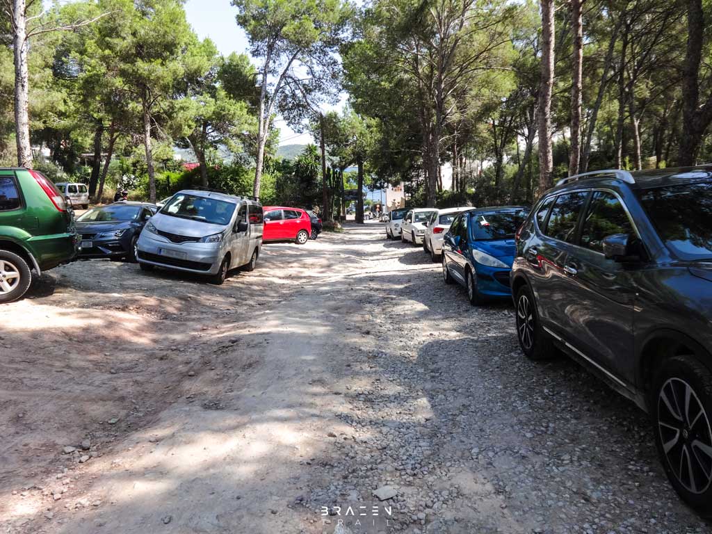
After parking in the dusty car park, make your way back down the road you drove in on. Keep going until you reach the bottom where the road bends to the left. At this point go right and wander past the car barrier of the hotel and into their car park. Keep your eyes peeled for some steps to the left (about 30 metres) that take you down to the ocean.
Go down the steps and turn right making your way through the sun loungers (summer only) and along the jetty. After about 30 metres some more steps should take you back up the banking and lead to a path that runs in front of the hotel. You will notice great uninterrupted panoramic views of the South West coastline from here ranging from Santa Ponsa to Cala Fornells.
After 100 meters, the path will disappear leading to a small woodland in a valley. There is a private property to the left sitting on the edge of the peninsula. Walk past that until you reach the South facing coastline.
Part 2: The South Coastline to L’Olla
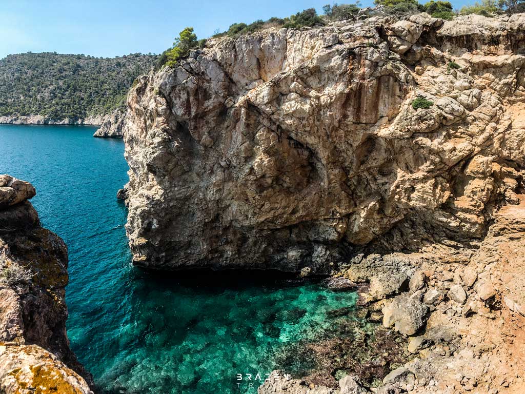
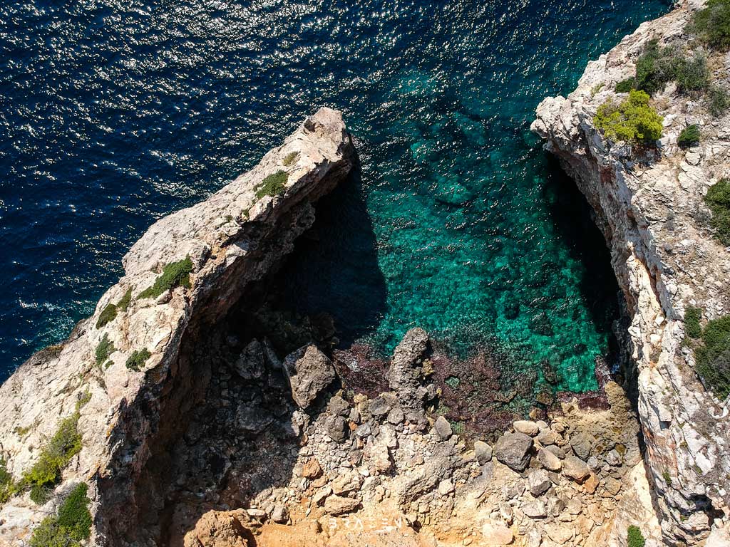
From here to L’Olla the paths can be quite vague and cairns are sporadic however finding your way isn’t hard. Simply follow any path that runs close to the coastline. After 400m or so you will come to the cove that is L’Olla. This is a natural cove where rock has weathered away leaving small bay with crystal clear waters. It is possible to scramble to the end of the rock pointing out but be careful as this is very dangerous.
Part 3: Cala d’en Monjo


After leaving the cove of L’Olla, head inland slightly until you join the main trail that carries on along the coast.
After following the path for a few hundred meters, you will come across a drystone wall with an opening. This used to keep the bay of Cala d’en Monjo private but the area is now open to the public. Pass through the wall and turn immediately left. Walking a few meters will reveal a stone sitting area which offers great views over the ocean. This is a nice and unique spot to stop and take in the view. A slight detour but worth it.
After leaving the stone sofa on the cliff, head back to the path where the opening was in the drystone wall and continue on the trail. The track will start to tack you down the hill toward Cala d’en Monjo. There are several ways down. Pick any, you can’t go wrong as long as you are heading down the hill.
Upon reaching the bottom of the hill, you will be in the bay of Cala d’en Monjo. Centuries ago, Cala d’en Monjo was a small boatyard. The cove offered protection from storms and bad weather allowing fishing boats to be worked on. Remains of jetties and a small boathouse can still be seen.
Now the cove is used by locals for relaxation. The waters are always crystal clear and make for great snorkelling. You won’t find much in the way of sandy beaches but that doesn’t stop most people. Cala d’en Monjo has also been declared an official nudist beach too so expect plenty of birthday suits in the summer months.
There was also once a military presence here which can still be seen with one remaining building. Normally we encourage the exploration of old abandoned buildings but quite often this ruin has squatters that have taken up residence so this is one to probably give a miss. The rest of the ruins are foundations but are interesting to explore regardless. After taking in the bay, make your way round to the far beach on the North side of the bay and start heading inland through the woodland valley area.
Part 4: The ascent up to Cap Andritxol
Keep heading West through the shady forest area for 200 metres until the track joins onto a wider, more predominant path. This path will keep going for 150 meters until it turns sharp right offering several ways up the short but steep ascent.
Take any of the paths up the hill. As long as you are going up, you are going in the right direction. There well could be a few rock scrambles depending on the route chosen. The way to the top may seem steep but doesn’t last for long. You will know you have reached the top as the scrambles will join onto a wider path, similar to the one we left at the bottom of the ascent.
Once on the wide path at the top of the peninsula, turn left heading in the direction that will take you out to sea. The path will remain wide and obvious for 100-200 metres before splitting off. The direction of travel will stay the same but the terrain will now have changed from a wide dusty track to narrow rocky trail. The trail will be well laid out with cairns and obvious to see from where other travellers have gone before you.
Keep following this path. It will cross in-between a fence at several points but this is an old fence from times before the area was made public. After 10 minutes or so you will have reached the end of Cap Andritxol. There is a small marker to say so. If you like, you can carry on quite a bit further past the marker but there is nothing more to see.


Part 5: Torre de Cap Andritxol
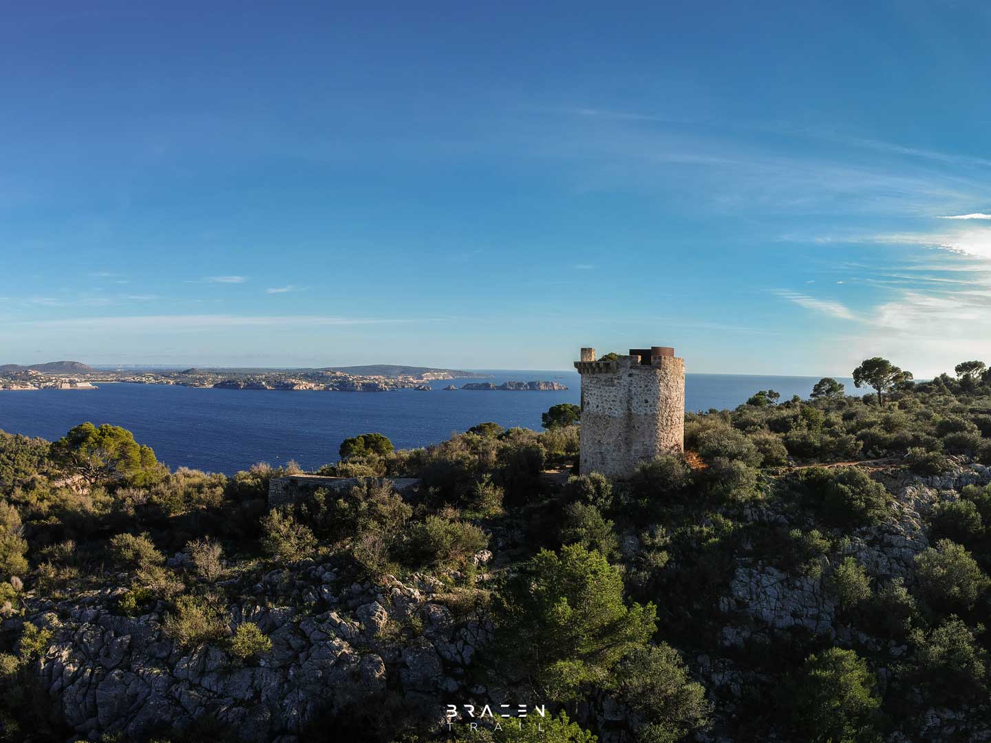
When you are ready to head back, the way is the same as you came in on so start by heading back along the rough, rocky track that crisscrosses through the fence. After 10 minutes you will reach a split in the track where the bay of Camp de Mar can be quite easily seen to the Northside. Take the left split and carry on toward the tower. In a few minutes, you will reach the Torre de Cap Andritxol. This is one in a series of twelve 500-year-old defence towers around the South West coastline. Find the route to Torre Cap Cala Figuera here. This tower has been kept in good condition however unfortunately, you cannot enter it. You can, however, take a look inside the old barracks just behind where lookouts used to live.
These towers served as lookout stations for the coastline to keep watch for pirates, smugglers and barbarians seeking to take over the island. From the top of Cap Andritxol, at least three other towers can be seen in the distance. The visibility from one to the other was crucial in notifying other settlements in the distance.
Part 6: The Way Back
Leave the Torre de Cap Andritxol, take the path that goes past the bunkers (square buildings) and keeps going. The trail will separate at several times and offer different ways down but they all lead to the same place so you can’t go wrong. The paths will snake their way downhill taking you back inland.
After 10 minutes or so, the path should come to a clearing. There will be several signposts and a fence. Be careful here as the signposts can be misleading and the direction we want isn’t actually there. The path you will want to take is in the opposite direction to the direction marked Camp de Mar. This should be the trail to the right (from the direction coming downhill) that goes through the opening in the fence.
After taking this path, the terrain will change to loose dry-stone and start to snake downhill quite steeply. After a few minutes, you will pass an old lime kiln to the left before that path opens up to a wider, more frequently travelled dusty track.
You are now on the main path to Cala d’en Monjo that we passed earlier. Keep on travelling in the same direction. Go straight on whenever you come to crossroads section in the path.
When the wide path levels out, you will be a few minutes from the car park where we started. This is the route finished. As a word of warning, be careful when leaving the car park as many have ripped off their front bumpers in the past over the uneven terrain.


Downloads & Resources

Related Posts
Route: Cap Cala Figuera via Cova de la Mare de Deú
A 2-3 hour casual circular route from Sol de Mallorca to Cala Figuera via Portals Vells, Cova de la Mare de Deú, Ex-Military Base, Lighthouse & Stone Tower.
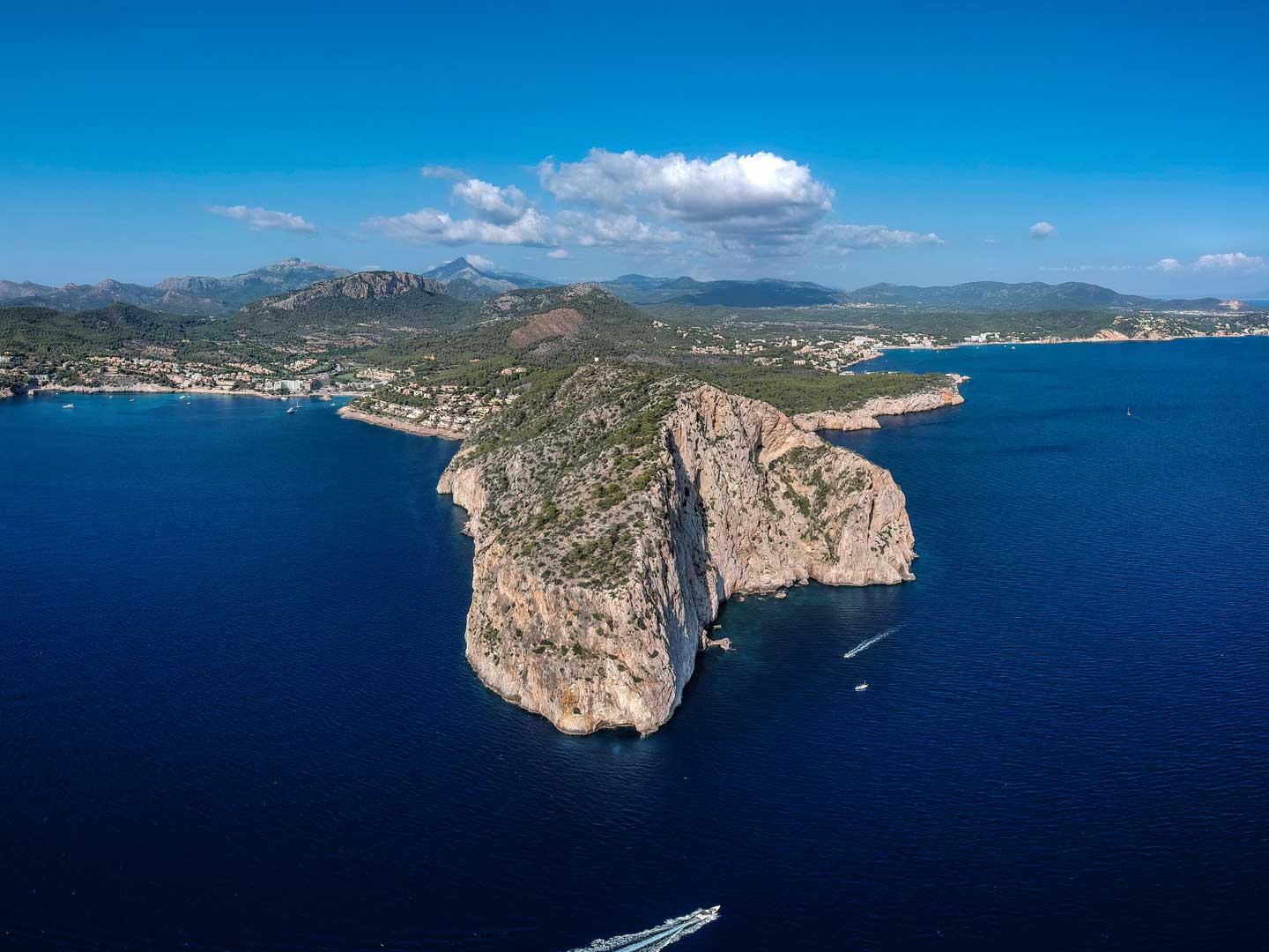
Route: Cap Andritxol via Cala d’en Monjo
A nice relaxed 2-hour route to the peninsula of Cap Andritxol. The walk starts in Cala Fornells, goes past L'Olla, Cala d'en Monjo & Torre de Cap Andritxol.