Overview
This route to Cala Figuera is really nice and easy going route. Just long enough at 10km to take up an afternoon at a steady pace and with almost no sharp assents, this route is one that any ability can take on however if your style is to push hard, the full circular can be done in 2 hours.
The Cala Figuera Circular also has one of the most intersting routes passing the cave of the Virgin Mary, an abandoned military barracks, the lighthouse of Cala Figuera (el Faro de Cala Figuera) oh and one of Mallorca’s more popular nudist beaches.
For those brave enough the tunnels can be explored that run under the old military base however they will be covered at a later date in a separate write-up.
A device with some form of basic navigation will be useful as tracks can become a little vague at times and there won’t be any signposts on route. For the casual user, we recommend the ViewRanger app which is available for Apple and Android devices. From the app you can download and follow our free route, just search Brazen Trail. There are some roughly cairned trails but with no definite route. They may not lead exactly where you had in mind.
Along the way you will experience a few cellular deadspots too but should you need to make contact, realistically the maximum time it would take to get back to a form civilisation is 30 minutes, less for mobile coverage.
Recommended Items to Take
- Sun cream as shade is scarce
- A camera as there are plenty of amazing photo opportunities along the way
- A headlamp or torch if you plan to explore under the barracks or caves
- Swimwear or a spare change of clothes as there is a spot to take a dip on the way
- Taking lunch can be a nice idea if you plan to make a full afternoon of it
- Plenty of water. We generally consumed about 3 litres in the summer months, less in the winter
Getting There
Just as the route itself, getting to the start point in Sol de Mallorca is straight forward and simple. For instructions, choose you transport of choice below.
The Route
Part 1: Sol de Mallorca and Portals Vells
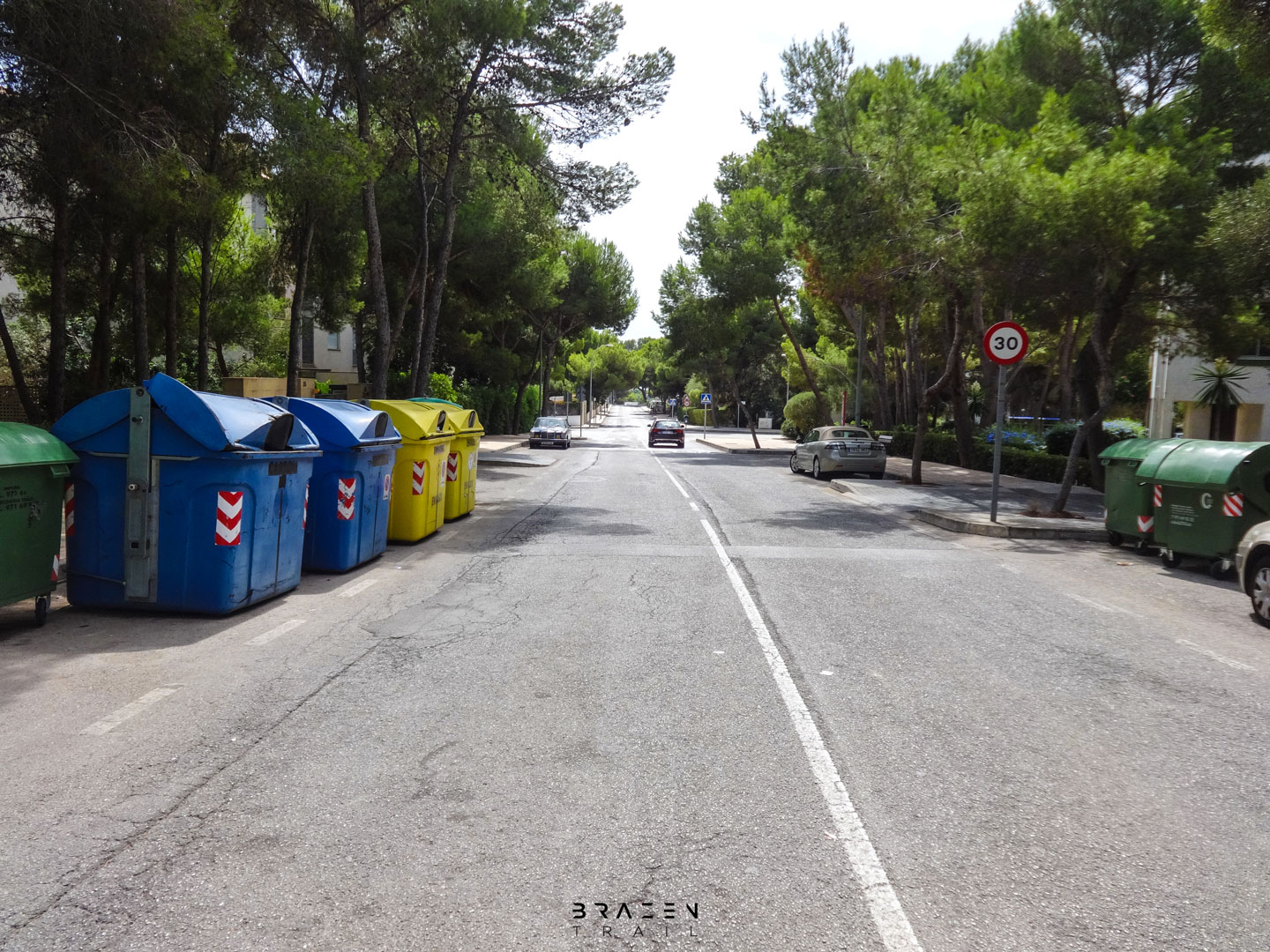
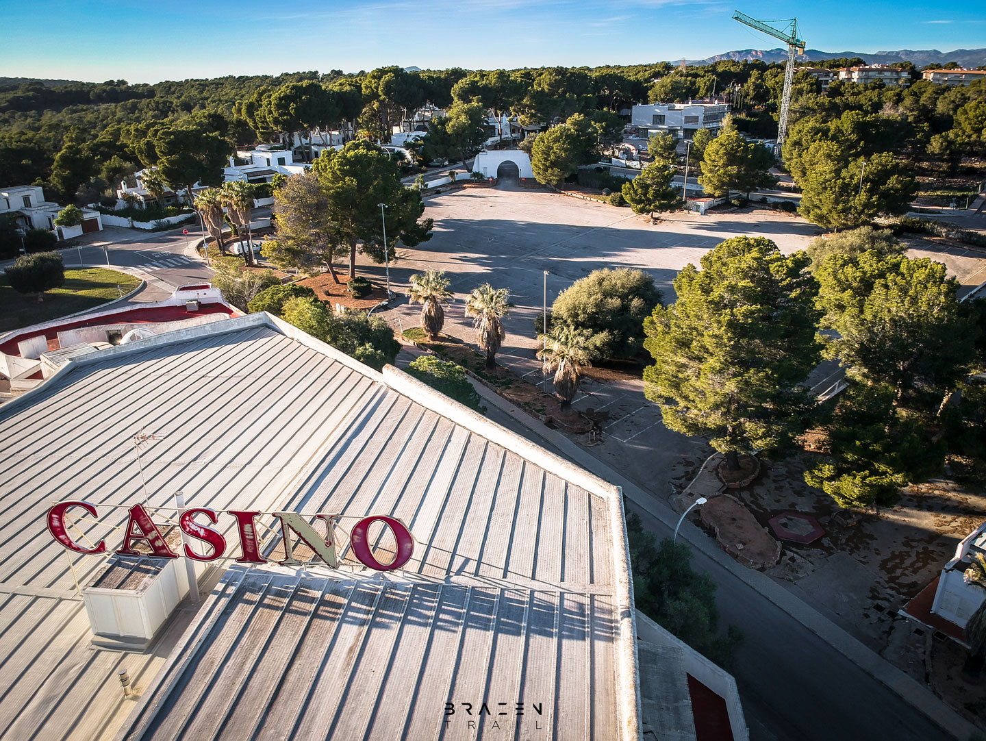
Once you have parked, start the route by travelling in the same direction of the way you drove in to Sol de Mallorca. This will briefly take you through this small and quiet urbanisation. You won’t find a lot here in the way of shops or cafés but the area is popular with people looking to live away from the hustle and bustle of Mallorca’s tourist destinations. On the left you will see the old Casino of Sol de Mallorca. Don’t get your 100 notes out just yet, it has been shut down for many years and has no plans of reopening in the future.
Part 1 Continued: Beaches of Portals Vells
Keep going along the coast path and you will come to the second beach (Cala El Mago). Waring, this is a full nudity beach. In the summer we tend to take the path that runs behind the restaurant instead of passing through nudists to carry on with the coastal path to…
The third beach (Playa Es Repós). Along the way to the third beach will be a small scrabble down some weathered limestone cliffs at which point if you look south, you should be able to see the ‘Cave of the Virgin Mary’ (Cova de la Mare de Déu). Pass through the beach, again carrying on the coastal path to…
The fourth and final beach (Caleta de Portals Vells). If you are taking this route in the summer, by now you will be pretty tired of beaches and naked people but don’t worry, we’re nearly away from civilisation.
Part 2: Cova de la Mare de Déu (Cave of the Vigin Mary)
After leaving Caleta de Portals Vells, carry on to the Cova de la Mare de Déu. This is a tiny detour but definitely worth checking out if you haven’t been before. If you want to explore the cave now would be a good time to take out the torch we recommended taking earlier. Inside the caves you will see beautiful historic carvings and hidden rooms. The caves are open to the public and completely safe so if you have time, take a nosy around.


Part 3: Cala Figuera


After leaving the cave, head back to where you came from and there should be steep banking to the South. There are several vague tracks that run up here but nothing obvious so make you way up and over the slope where a level clearing should await you at the top.
This clearing (Punta de Xisclet) is a favourite spot for camper vans and the like to set-up shop given it’s amazing views and tranquility however Spanish laws are very grey on such things and probably not officially allowed. Also from the top you should be able to see the ‘Torre de Portals Vells’, to the North, an old defence tower dating back the 1500s.
From here on out to Cala Figuera carry on along the cliffs staying no further than 30 meters away. There are a few paths and loosely cairned routes but if you are following the coastline South, you are going in the right direction. After 1km you will come across a cove that cannot be crossed at which point you will need to come inland slightly to walk around the cove to join back onto the coastline again.
A few minutes later, the trail will bring you onto Cala Figuera. This small pebbly beach can be a popular spot with locals in the summer and on Sundays but is generally very quiet. It is also a favourite place for boats to anchor up and enjoy the untouched scenery. It can also be a nice place to stop and enjoy some lunch.
Unfortunately, this beautiful little cove is also an example of how polluted the coastlines and oceans are becoming with the bay often filled with micro-plastics and rubbish.
Part 4: Abandoned Military Base (Zona Militar)
The way off the beach is not exactly obvious at first but there are some steps cut out of the rock to the South which will take you up and over the hill to a gravel road and on your way to the old military base.
A five minute walk south on the gravel track will bring you to the first structures of what used to be a Spanish military zone. In the first section you will find an old canteen and chapel, along with what looks to be a small residential property probably occupied by a local ranger. Our route doesn’t take you exactly through the ex-miliary base however we recommend a detour to have an explore.
As you get closer to the lighthouse, you may stumble across some abandoned canon placements to the left of the main track. Underneath, there are bunkers and tunnels that reach for miles. There is no natural light inside these bunkers and tunnels so if you are wanting to explore them, you will need a torch or headlamp but be warned: they are very spooky. Enter at your own peril!


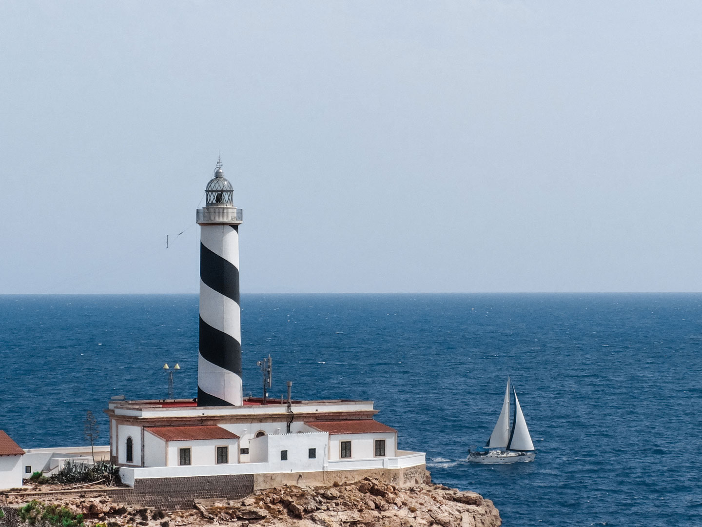
Part 5: Cala Figuera Lighthouse (Faro de Cala Figuera)
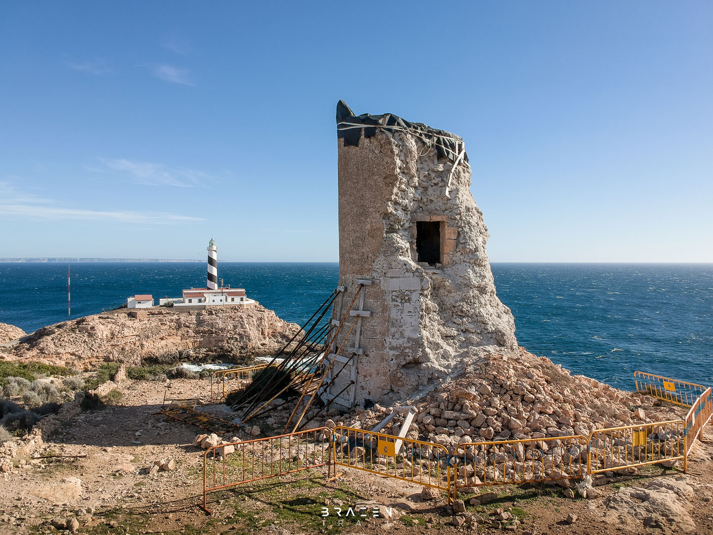
Once your exploring itch has been scratched in the abandoned military structures, take a wander over to the lighthouse of Cala Figuera. You cannot go into the lighthouse as the area is private and maintained but makes for some great photographs.
You cannot also miss the large radar instalment to the North of the lighthouse which appears to be a guidance system for Palma airport runway.
Carrying on the trail, you will also note one more of the 15th century defence towers similar to what could be seen from the cliff top in Portals Vells looking North earlier. Unfortunately this one has been weathered away and is one of the least maintained towers in the South West.
Part 6: Punta del Toro
Leaving Cap de Cala Figuera, you will want to walk past the defence tower following the coastline once more. As before, there are some vague paths and trails but as long as you are within 30 meters of the cliff edge you can’t go wrong.
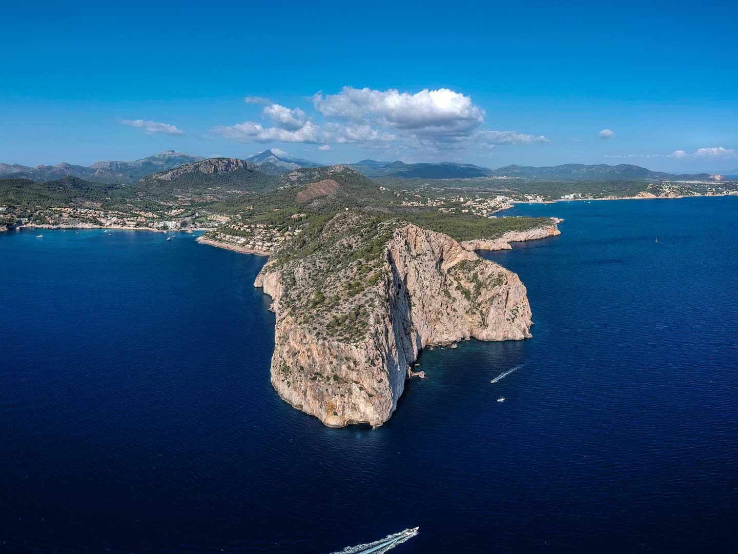
After around 2km, if following our route you should come to a small peninsular which will offer staggering views of ‘Punta del Toro’ and another great photo opportunity. This is a very windy area of the island so be careful if standing nearly to cliff edges.
Part 7: Heading back
Now the sights have been seen and photos taken it is time to start heading back inland towards the finish point. Head North along the clifftop for 500m and lookout for trails to the right taking you inland. You will want to start heading inland (bearing NNE) just before the trail starts to bank left along the main El Toro peninsular.
After a few hundred metres, the trails will join onto wider bridleways which will start to bear East and will finally intersect a road which leads to the beaches of Portals Vells visited earlier. If you see an old white checkpoint hut with the Portals Vells Restaurant advertised on the side you are in the right place.
At this hut, cross the road into the clearing at the other side where a steep path will take you downhill and into a valley. Coming out the valley you will pass an orange grove to the left. There should be a gap in the dry stone wall that separates the grove from the forest area to the right. Go through this gap and carry along the path through the forested area.
After the forest opens up, stay on the path. You should see a line of electricity pylons that run from Sol de Mallorca to the lighthouse of Cala Figuera.
Finally the path will take you through a smart residential complex and out onto the road where we started.


Downloads & Resources

Related Posts
Route: Cap Andritxol via Cala d’en Monjo
A nice relaxed 2-hour route to the peninsula of Cap Andritxol. The walk starts in Cala Fornells, goes past L'Olla, Cala d'en Monjo & Torre de Cap Andritxol.
Route: Cap Cala Figuera via Cova de la Mare de Deú
A 2-3 hour casual circular route from Sol de Mallorca to Cala Figuera via Portals Vells, Cova de la Mare de Deú, Ex-Military Base, Lighthouse & Stone Tower.